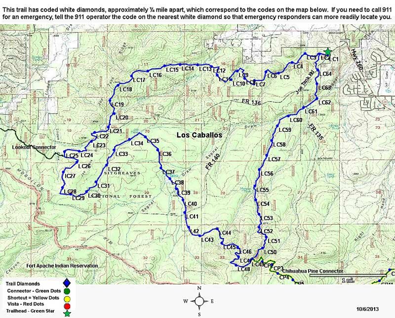
Los Caballos Trail #638
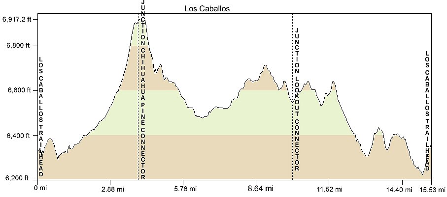
Distance: 15.5 miles
Difficulty: (as rated by the US Forest Service)
Hiking - Difficult
Mountain Biking - Difficult
Equestrian - Difficult
Trailhead Parking: Yes, accommodates Trailers
Access to Trail: From Show Low Post Office, travel west on AZ 260 for 3.9 miles. Turn left on FR 136 (Joe Tank Road) and the trailhead is .6 miles ahead on the right.
Trail Highlights: Los Caballos Trail travels through burned and unburned forest and includes a number of steep grades. The majority of the trail follows old logging roads as it winds along Joe Tank Ridge and through Bagnal Draw. The trail has been signed with blue diamonds since the Rodeo-Chediski fire burned out much of the old markings. Watch for fallen and blown down trees along the trail. This trail offers an interesting look at the ecology that follows a forest fire.
Los Caballos Trail
Printable Map