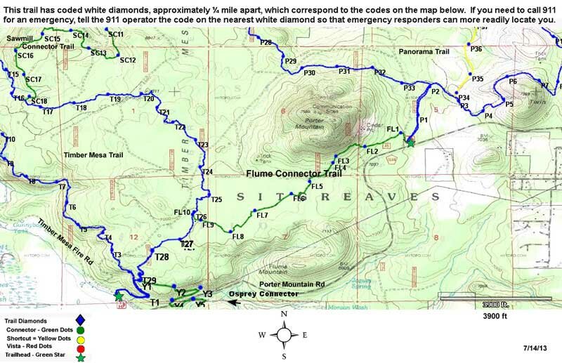
Flume Connector Trail #636B
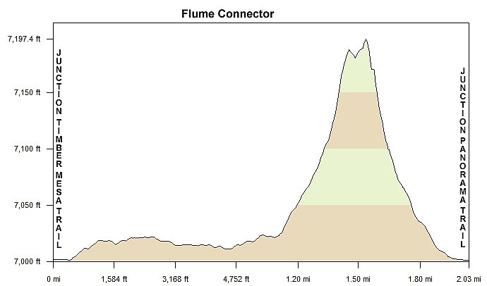
Distance: 2.5 miles
Difficulty: (as rated by the US Forest Service)
Hiking - Moderate
Mountain Biking - Moderate
Equestrian - Moderate
Trailhead Parking: Use Timber Mesa or Panorama Trailheads. Both accommodate trailers.
Access to Trail: From the Lakeside Ranger Station, travel south on AZ 260 for 0.1 mile. Turn left on Porter Mountain Rd. (FR 45) for 2.2 miles, then right on Porter Mountain Rd. (FR 45) at the junction with Penrod Rd. Take a left at .5 mile for Timber Mesa Trailhead or continue on Porter Mountain Road for 3.8 miles and turn left to Panorama Trailhead. The Flume junction at the Panorama Trailhead is about 100 yards north from the kiosk.
Trail Highlights: Both connector trails (636A and 636B) cross the top of Timber Mesa, one to the north of Porter Mountain and one to the south. The Flume Connector is named for the flume (pipe) which carries irrigation water. The flume is visible on the south side of FR 45, just east of the Timber Mesa Trailhead turnoff.