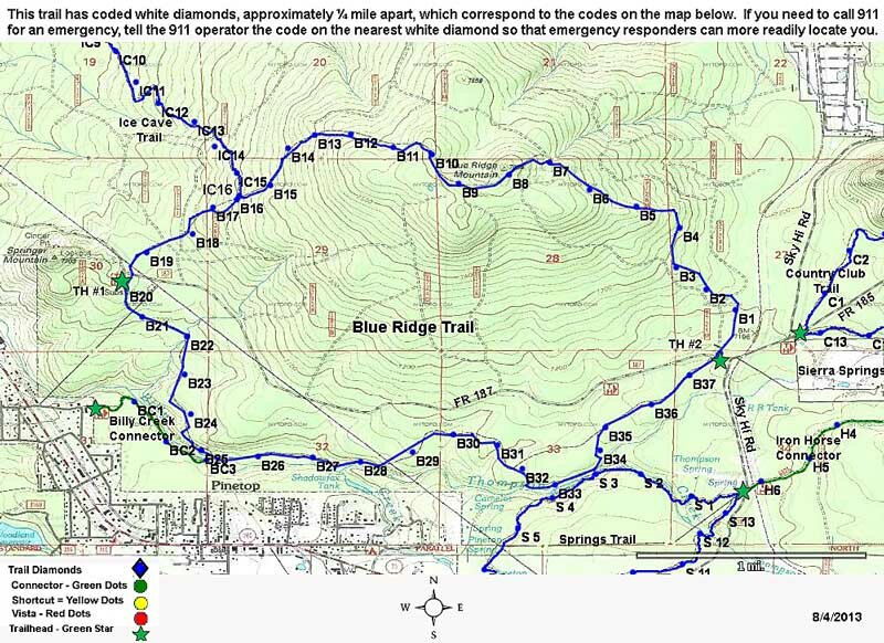
Blue Ridge Trail #107
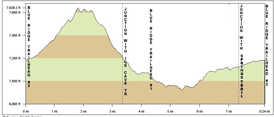
Distance: 8.4 miles
Difficulty: (as rated by the US Forest Service)
Hiking - Moderate
Mountain Biking - Difficult
Equestrian - Moderate
Trailhead Parking: Yes. Accommodates trailers
Access to Trail: From the Lakeside Ranger Station, travel south on AZ 260 5 miles. Turn left on Bucksprings Rd, then left again on Sky Hi Rd (FR182) and left on FR 187 to Trailhead #2. Continue on FR 187 to Trailhead #1. Or you can access Trailhead #1 from AZ 260: turn north on Moonridge, right on Billy Creek, left on Meadow to cross the bridge, right on Pine Shadow, go around the curve to the left then right on FR 187 for about .8 mile to Trailhead #1 on your right.
Trail Highlights: The trail follows Billy Creek and winds through a ponderosa pine forest to the top of Blue Ridge Mountain. The mountain is volcanic in origin and it's summit offers scenic vistas. Connector trails head southeast to Springs Trail and northwest to Ice Cave Trai